In 2014, the Minister for the Environment introduced the European…
How healthy is the Suir Catchment?
Do we have the balance right between living and working in, and maintaining a healthy Suir catchment, and if not, what do we need to do to redress the situation?
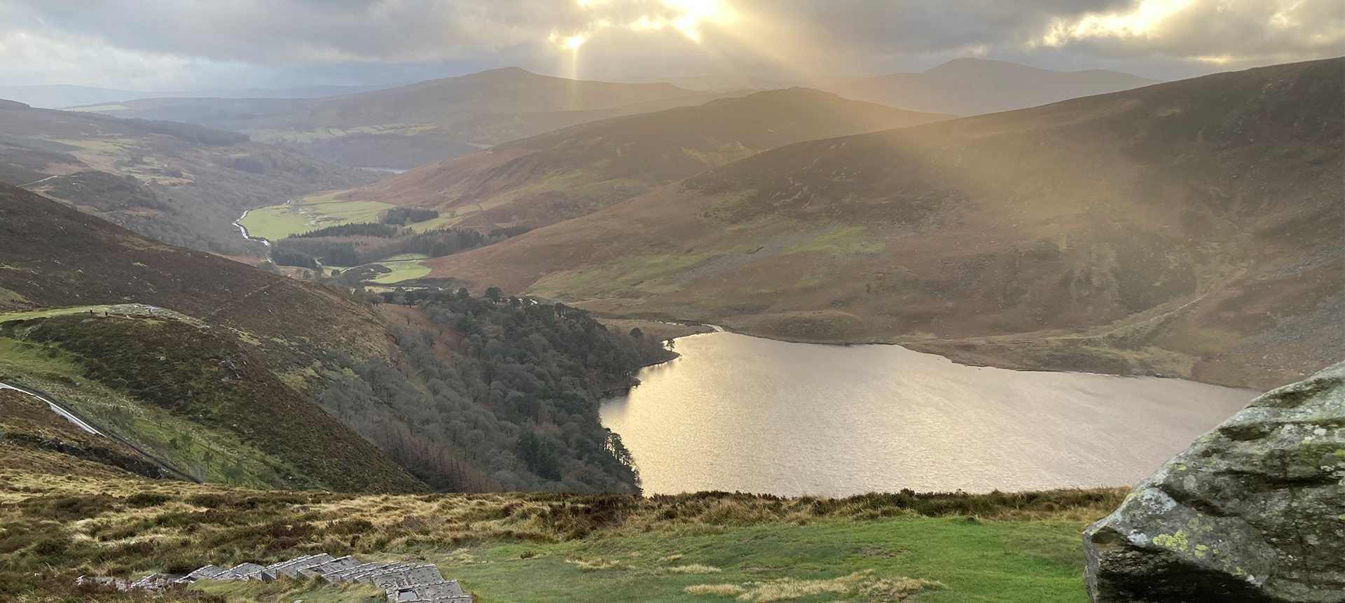
The Suir catchment is 3500 km2 in size, rising on the Devil’s Bit Mountain and flowing out to the sea at Waterford Harbour.
The population in the catchment is approximately 200,000 spread across several major urban centres, including Thurles, Tipperary, Cashel, Clonmel and Waterford, and the rural population.
Much of the catchment is freely draining with good farm land. Farming is consequently relatively intense in some areas. The density of domestic waste water treatment systems (septic tanks) is approximately 8 per km2. There are forestry operations in the upland areas of the Galtees and the Comeraghs, and peat extraction in the lowland areas east and northeast of Thurles. There are also mines, quarries, industrial activities and wind farms. However despite this high level of human activity in the catchment, there are also significant nature conservation values and places where biodiversity is known to be relatively high. For example, the River Suir is a known salmonid fishery. The catchment also contains 3 Special Areas of Conservation (SACs) designated under the Habitats Directive to help protect rare animal and plant species, and a Special Protection Area (SPA) designated under the Birds Directive. There is even a small freshwater pearl mussel subcatchment that flows into the Suir downstream of Waterford.
So the catchment supports a wide range of livelihoods and ecosystem services, but how are the catchment’s aquatic ecosystems coping with all these activities?
Do we have the balance right between living and working in, and maintaining a healthy Suir catchment, and if not, what do we need to do to redress the situation?
This question is central to the Water Framework Directive river basin management planning process. Plans are made every 6 years containing actions to enhance and protect water quality and the ecosystems that depend on it. We are currently in the characterisation stage of the 2nd planning cycle which is due to culminate in our 2nd cycle plans being completed at the end of 2017, and implemented between 2018 and 2021. Characterisation of water bodies is a critical element of the work required under the Water Framework Directive, and is about understanding how our catchments work and how human activities impact on water, in order to prioritise appropriate actions that ensure that we do get that balance right.
In this 2nd cycle our philosophy is about looking for ‘the right measure in the right place’ to achieve the best outcome, which will build on the ‘one size fits all’ approach of the last cycle. The EPA, with the assistance of RPS consultants, the local authorities and the Inland Fisheries Ireland officers, are currently working through characterising all of Ireland’s streams, rivers, lakes, estuaries, coasts and groundwaters, one by one, to determine what and where the water quality issues are, what are the significant pressures causing those issues, and what can be done about them. All the information is being recorded in a new EPA water management system, known as the Water Framework Directive Application, which is being made available on this website.
So what did we find in the Suir catchment?
In general aquatic ecosystem health in the Suir catchment is fairly good.
The majority of surface water bodies were “Not at Risk” i.e. are expected to meet their Water Framework Directive objectives, meaning that no further actions are required in addition to the basic requirements of the current regulations and best practice management. Water quality trends are also generally improving across the catchment although there are some key hotspot areas where problems continue to arise.
64 (35%) surface water bodies, including the Suir estuary and 4 small groundwater bodies, were found to be At Risk and will require specific measures to achieve improved water quality outcomes. The vast majority of the water bodies containing the protected areas had also already met their objectives.
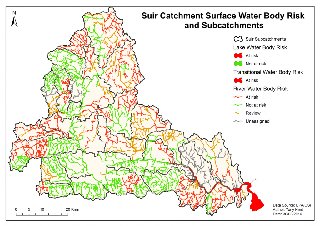
The most significant water quality issue is excess phosphorus (P) from a variety of sources including human and animal wastes and fertilisers, leading to eutrophication, which is impacting on rivers, lakes and estuaries. Groundwater provides a significant pathway for delivery of phosphorus to surface waters in some places, and is impacted by industrial sites and a landfill in the four small key areas. Poor habitat quality and excess sediment from peat extraction, forestry and channel maintenance, as well as excess ammonium from the worked peat, are also important issues in specific areas.
The most widespread significant pressure in the Suir catchment, in terms of numbers of water bodies impacted, is agriculture. Agriculture is also probably one of the most challenging pressures because it is widespread, and the sources of pollution sources are diffuse, for example from fertilisers or pesticides being spread, and from faeces and urine from livestock in fields, as well as small point sources, all of which can be difficult to manage.
The next step is to use the range of tools now available to us, which are described in other articles on this website, to help pin down exactly where and what the issues are in the problem areas we have highlighted and identify precisely what needs to be done to resolve them. We know from catchment and estuary modelling that if we can reduce the losses of P from a relatively small number of river water bodies, this should also be enough to bring the P reaching the estuary back to levels that would support Good status. Twenty investigative assessments have been targeted for the relevant local authorities to prioritise. These will be carried out using the pollution impact potential maps to help focus the effort. We’ll be adding more posts to the website to explain each of these concepts.
The specific problems that are identified will be rectified using a mix of engagement, accessing voluntary incentive schemes and enforcement of existing regulations. In addition, Irish Water plan to deliver structural improvements to two waste water treatment plants within the Suir catchment by 2021, and a further five by 2027, which will have positive impacts for water
quality overall.
A collaborative, focussed effort will be needed to tackle the significant pressures identified in the Suir catchment. It will need to involve multiple agencies, including staff from the new Waters and Communities office, and the local landholders. Such a collaborative approach will be essential to achieve that balance that will sustain a productive, yet healthy, Suir catchment for the long term.
Article by Jenny Deakin, EPA Catchments Unit
